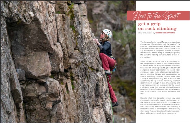
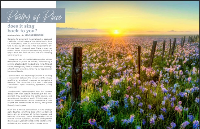
Immerse yourself in captivating photography, thrilling outdoor stories, insightful geology and history features, inspiring artist and business spotlights, fun road trips and day hikes, thoughtful editorials, state park spotlights and so much more.
Join us in appreciating the greatness of the Gem State as we transition through the seasons.
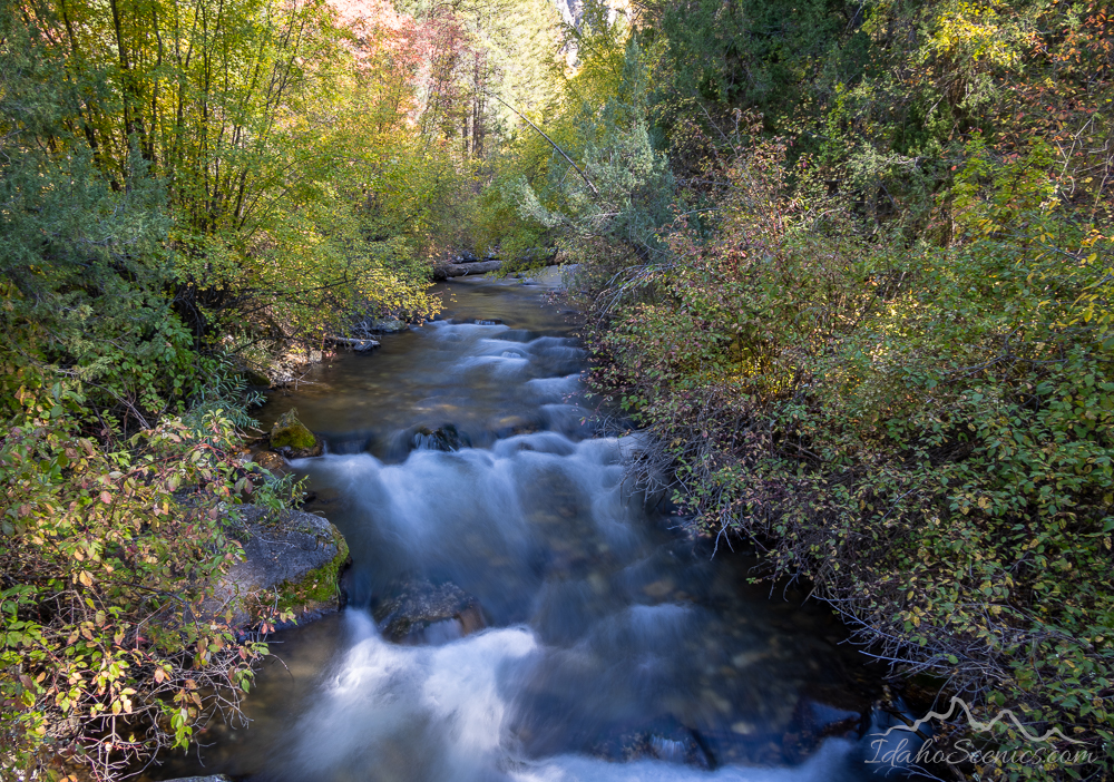
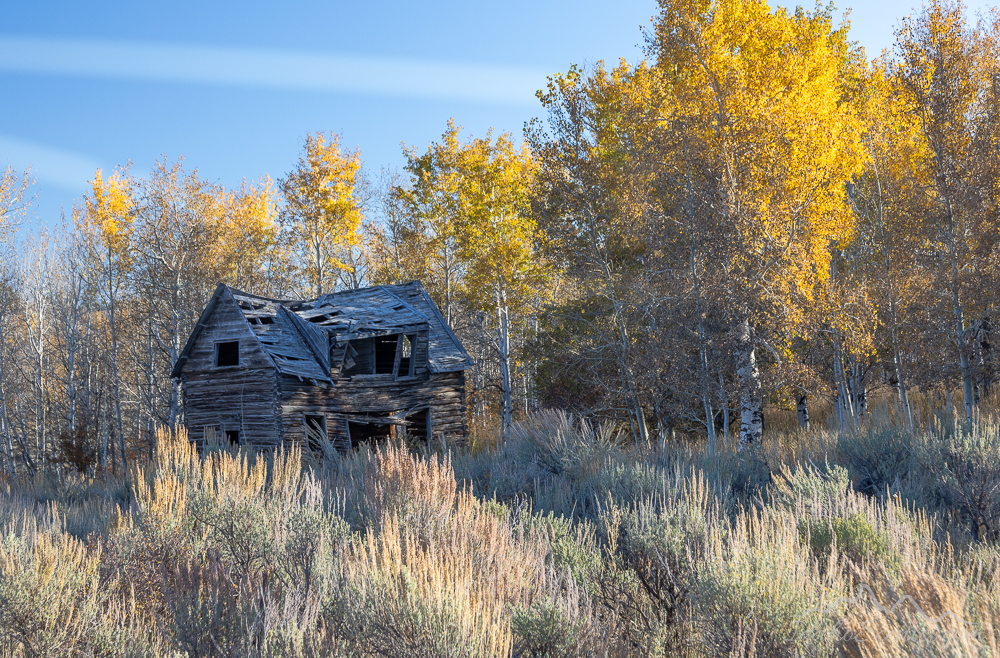
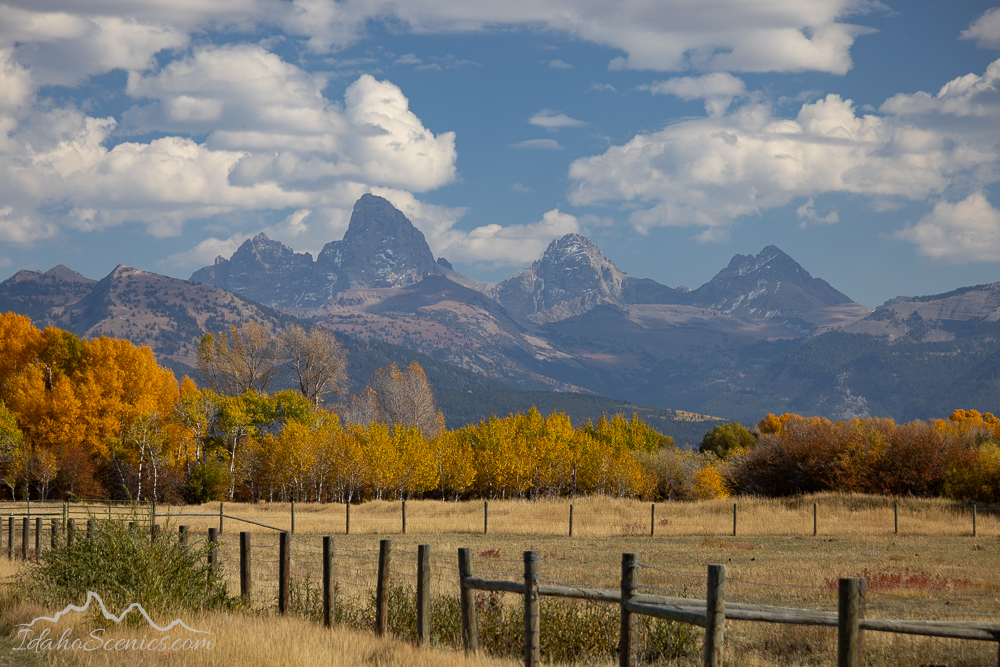
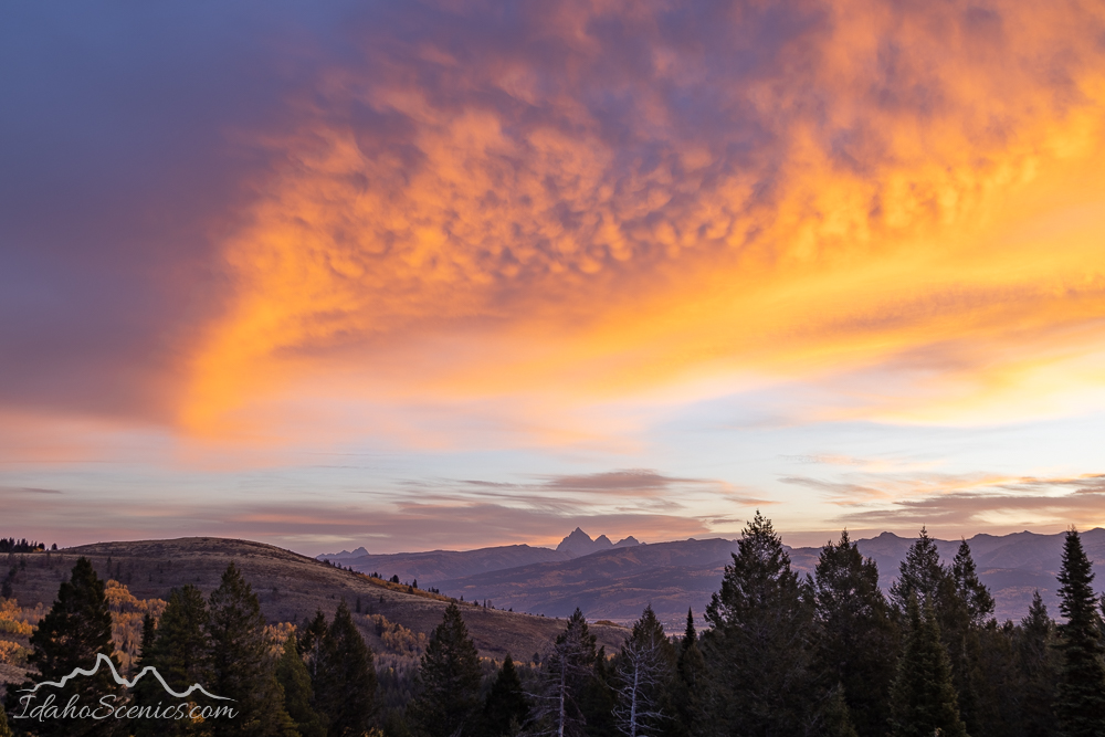
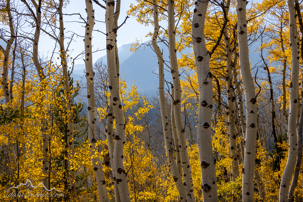
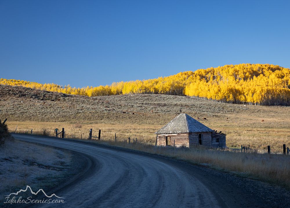
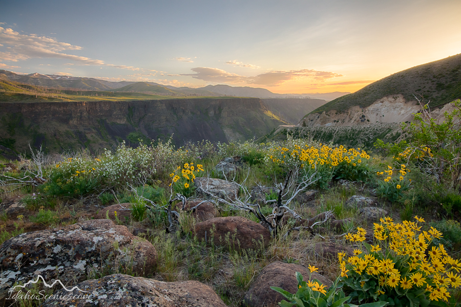
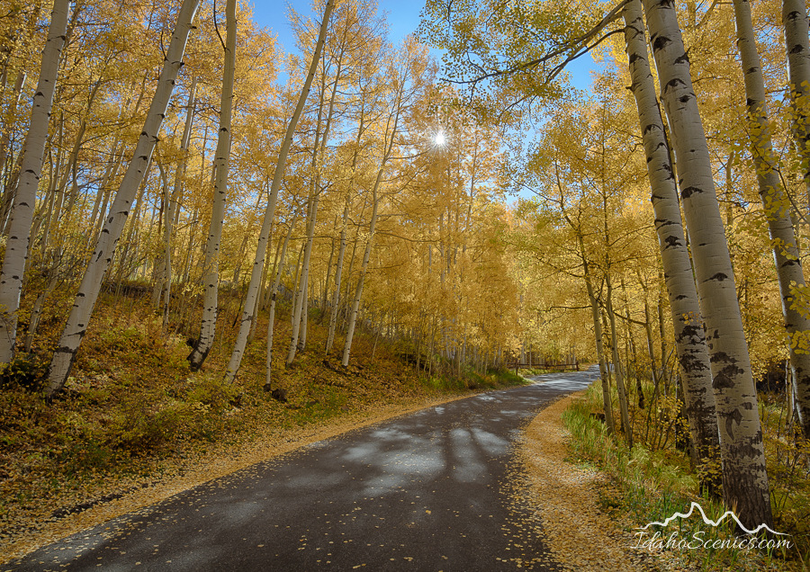
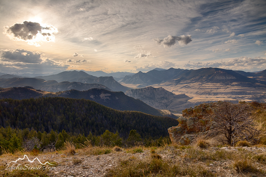
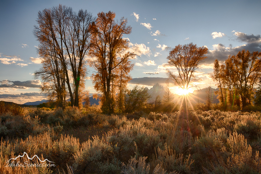
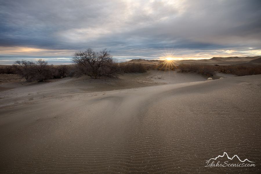
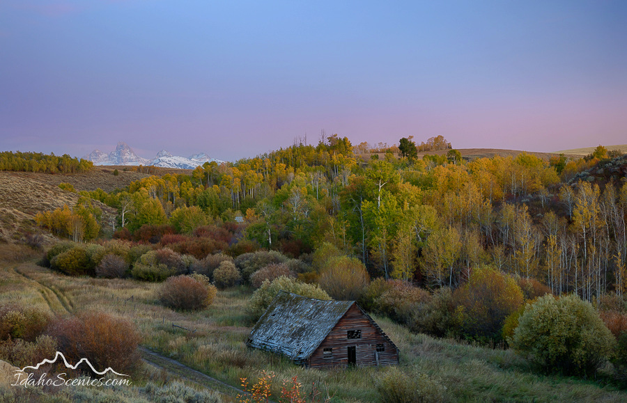
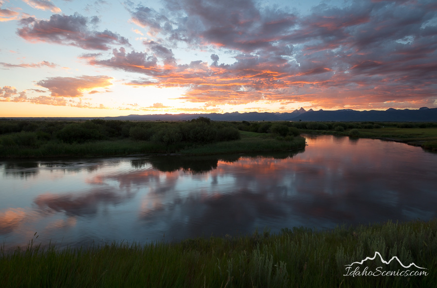
I met up with some photography friends in early October in the Teton Valley for 7 days of wonderful photography. It was so good to be traveling and shooting again!
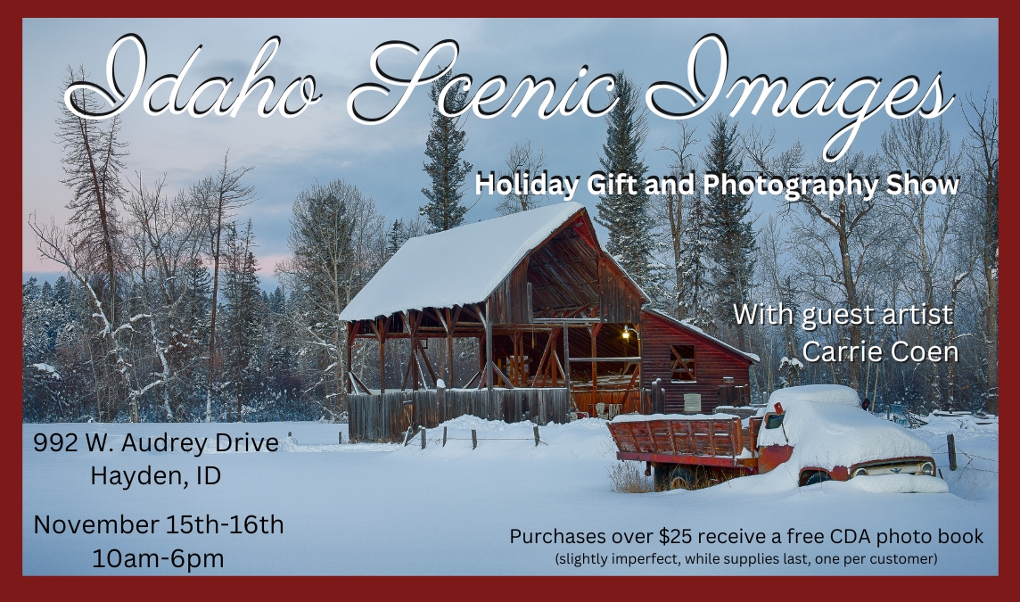
Now I’m prepping for my Holiday Art and Gift Show I’m having in my home here in Hayden, Idaho in two weeks! If you’re in the area, be sure to stop in!
I’ve scheduled three Idaho destination photography events for 2025. Check out my website for info and registration! http://www.idahoscenics.com
Hopefully I’ll post again before 2 years goes by, hahaha! Follow me on Facebook for more images and news!
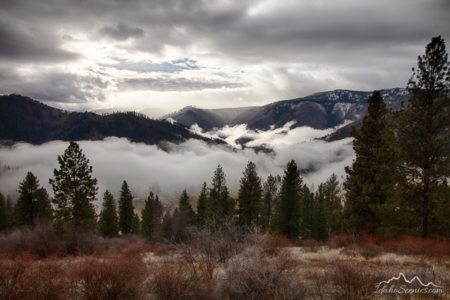
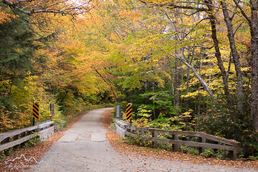
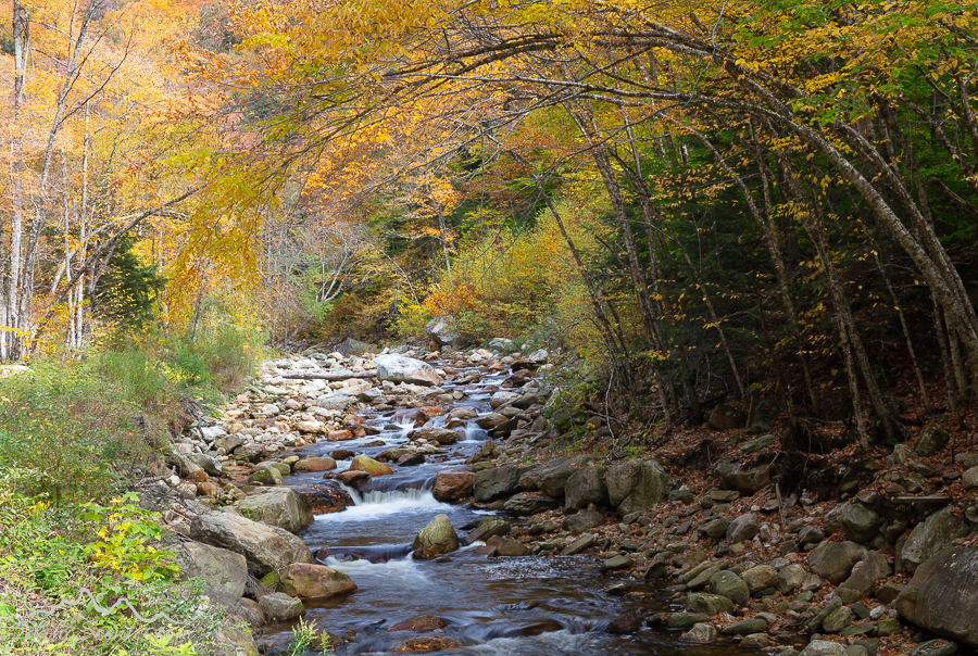
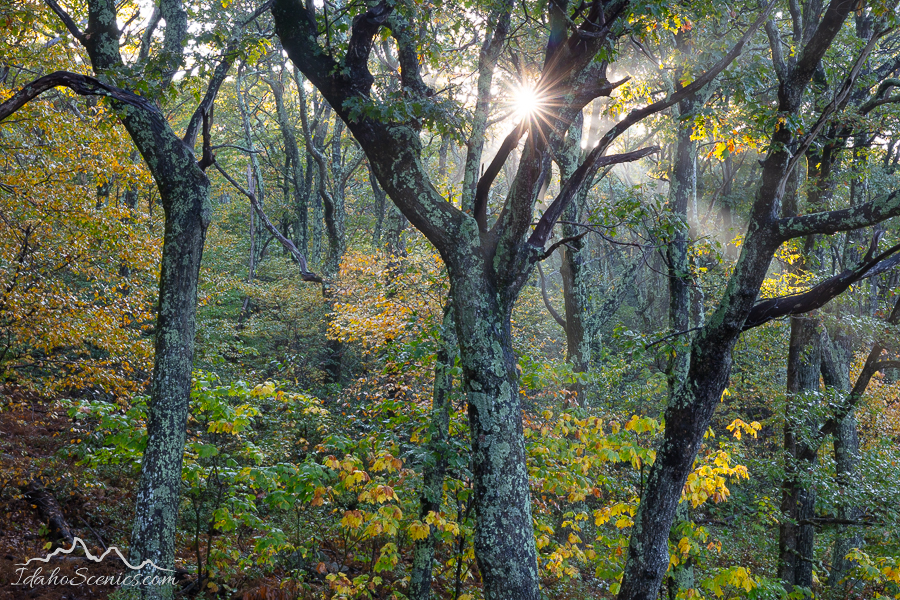
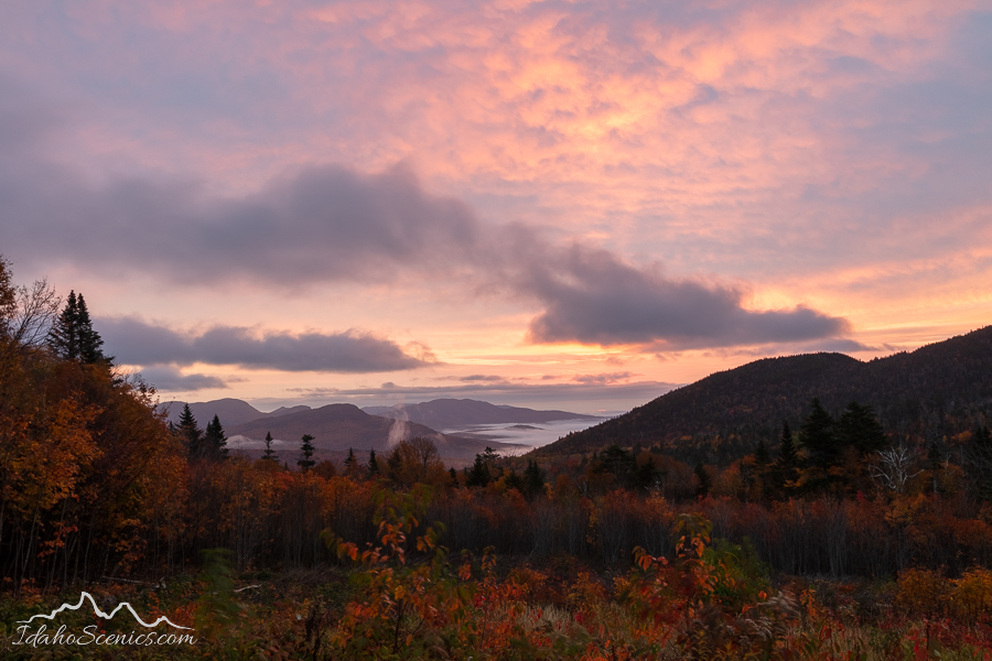
Wow, I had no idea it has been so long since I last made a blog post. It’s as if all of 2021 and 2022 didn’t even exist. I almost wish, since these have been especially difficult years for me. Amongst all of my ongoing medical issues, I have found some peace and tranquility in a few photo shoots though. I’ll just post a few favorites here from 2021 and hope to catch up again next month with a 2022 review.
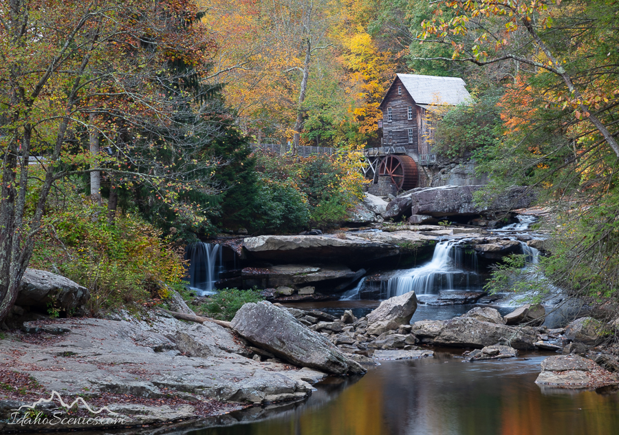
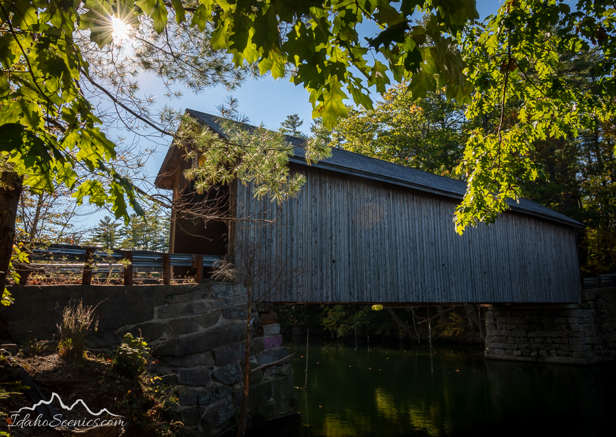
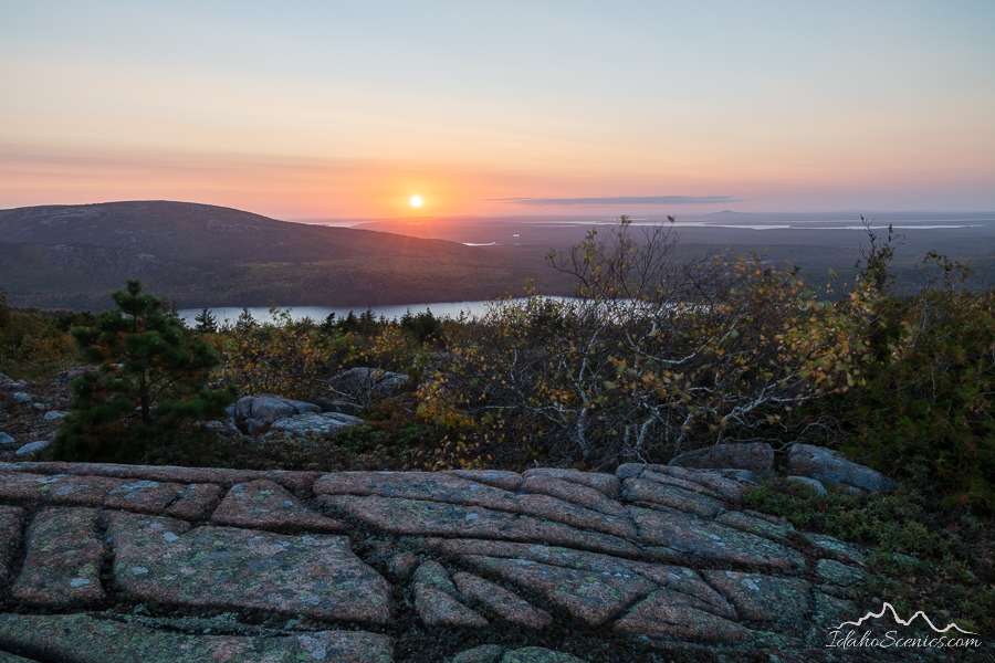
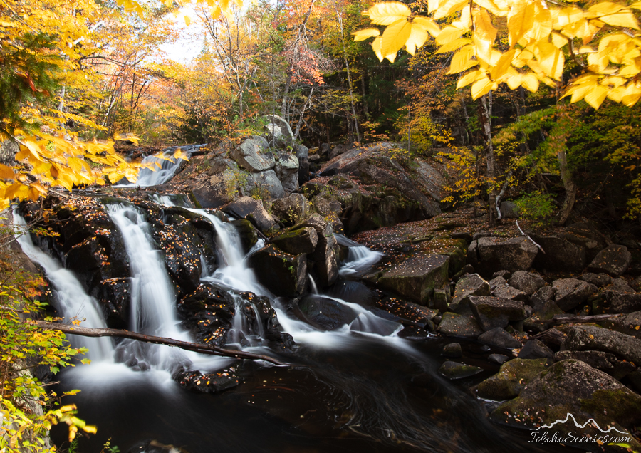
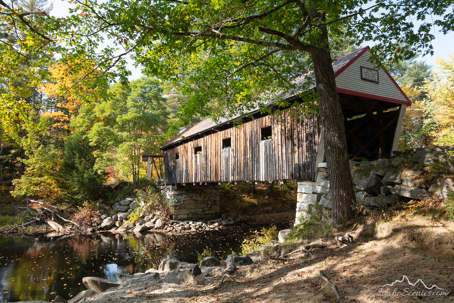
The following images were taken on a cross country road trip in October 2021, which included photo stops in Maine, New Hampshire, Vermont and West Virginia for the most part. A bucket list trip I took with my sister.
I hope you enjoy the images!
Please consider subscribing to my e-newsletter where I do post about once a month. 😉
2020 comes to a welcome end tomorrow, and I’ve been thinking about this last year and all it has been. While it had so many challenges and disappointments, looking through my images from the year, I was pleasantly surprised at all the good memories I had and the images I was able to create. I’m not going to go into detail about each image but I had to narrow this down from about 50 favorites, which included wildlife, nature and even some people. But, staying true to my passion, I’ve settled on 20 landscapes for my tribute to the year. Watch for another post with some other subjects.
Aspen Road
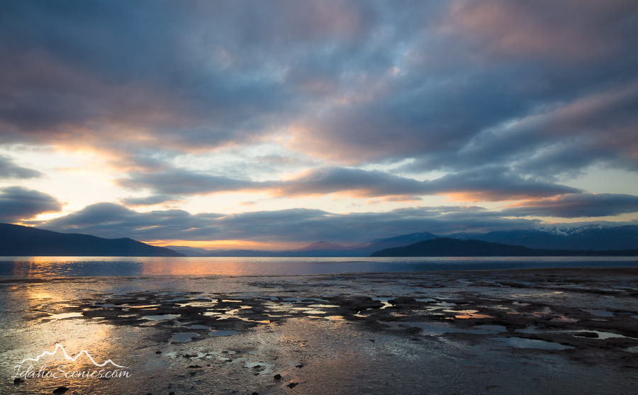
Pend Oreille Pastels
Autumn Dawn
Mountains Majesty
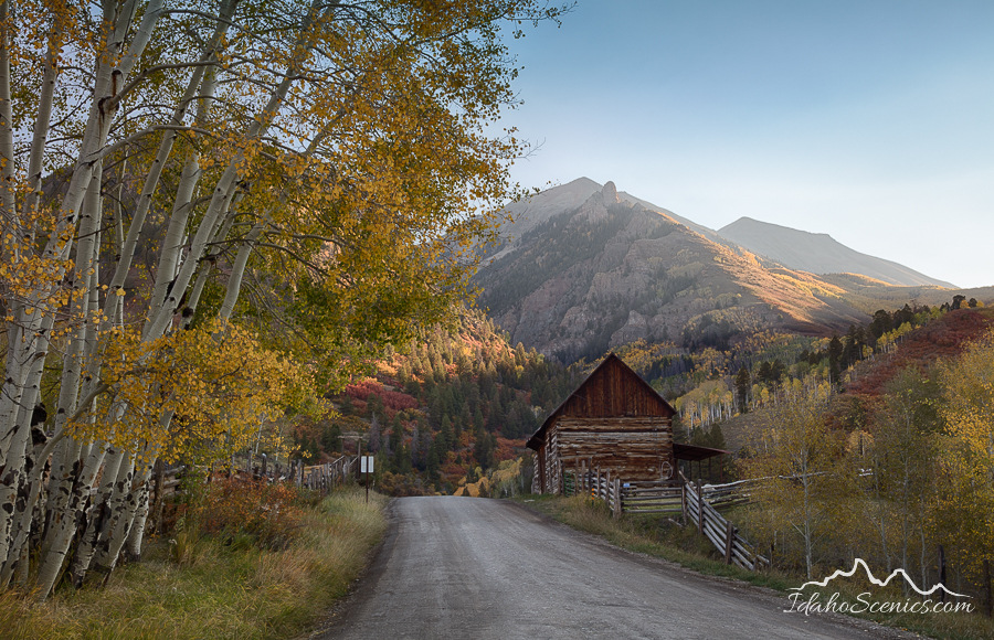
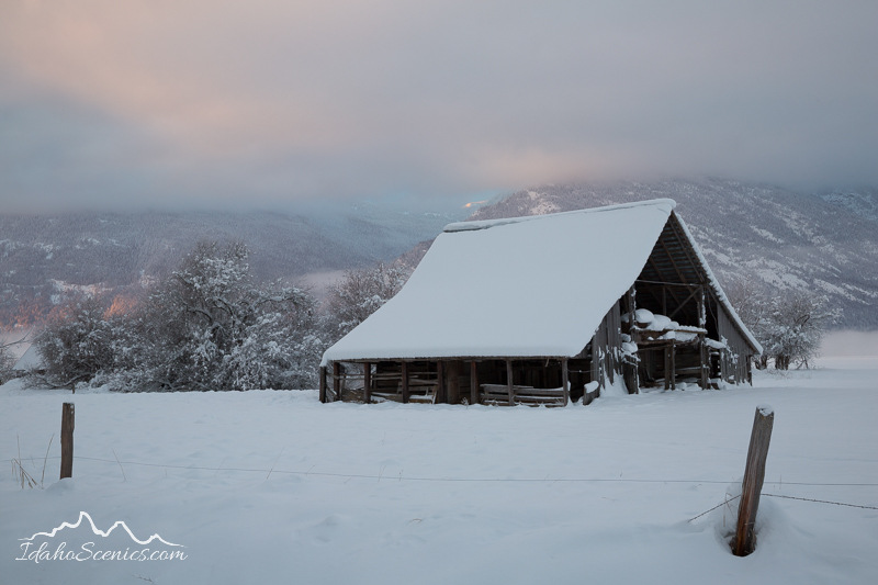
Last Dollar Barn
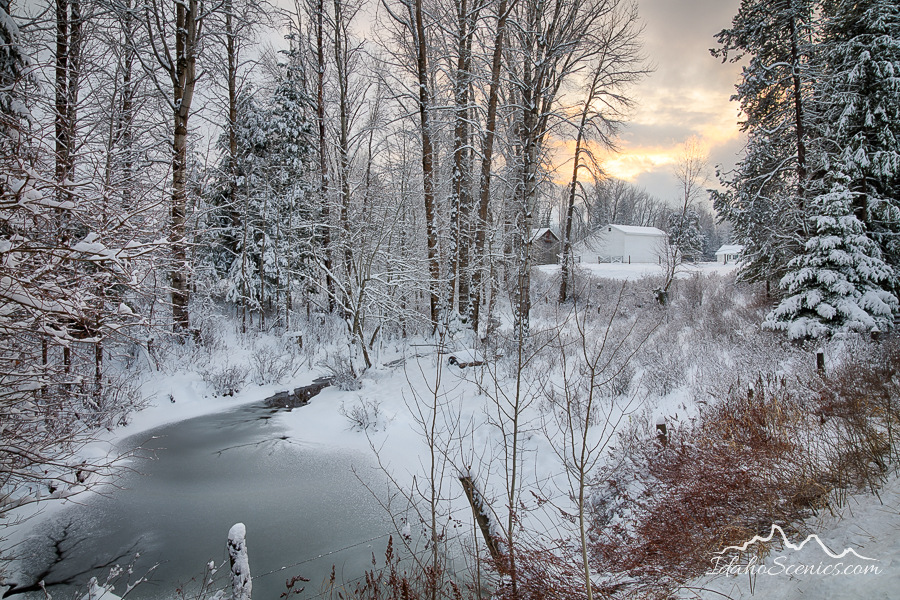
Winter Countryside
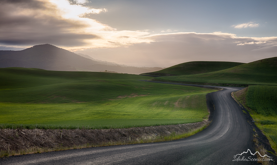
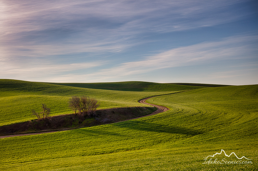
Palouse Curves
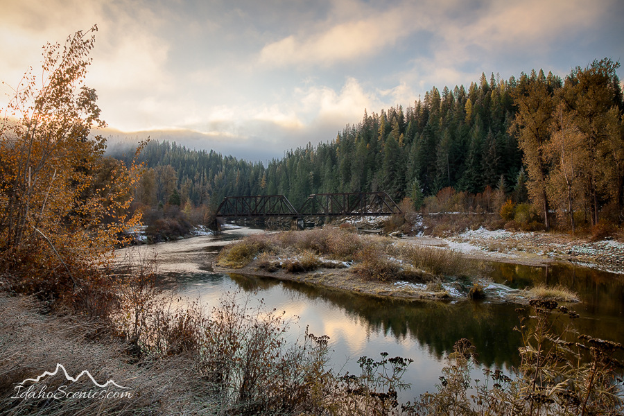
Clark Fork Mists
New Beginnings
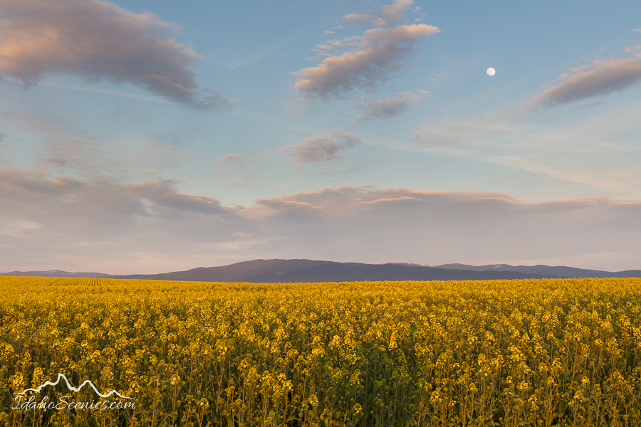
Moon over the Canola
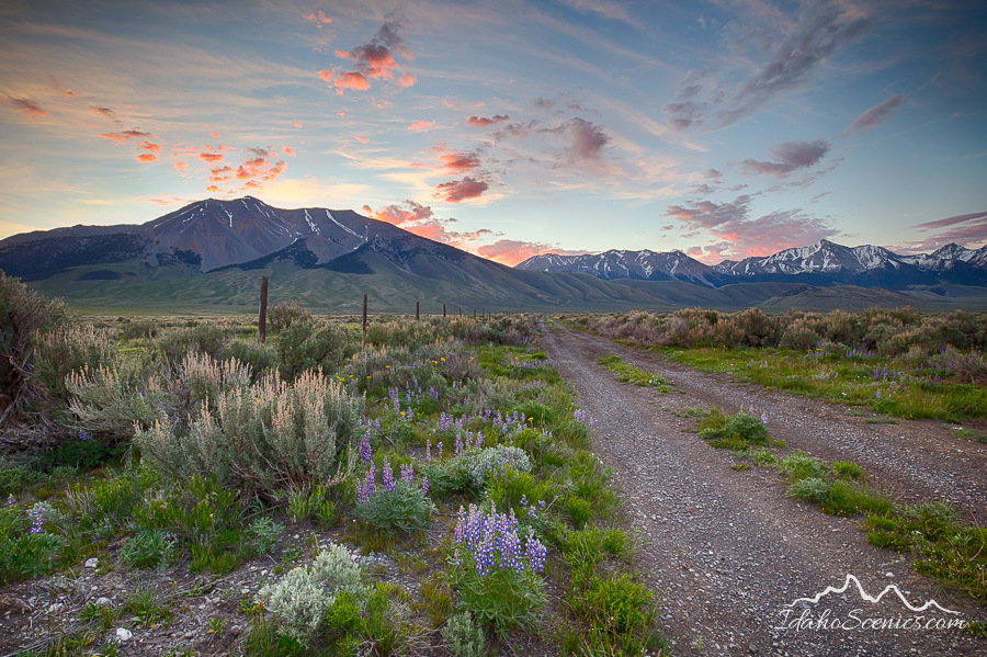
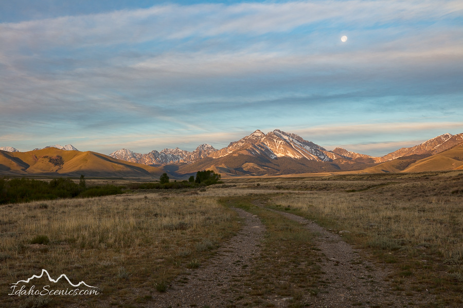
Lost River Road
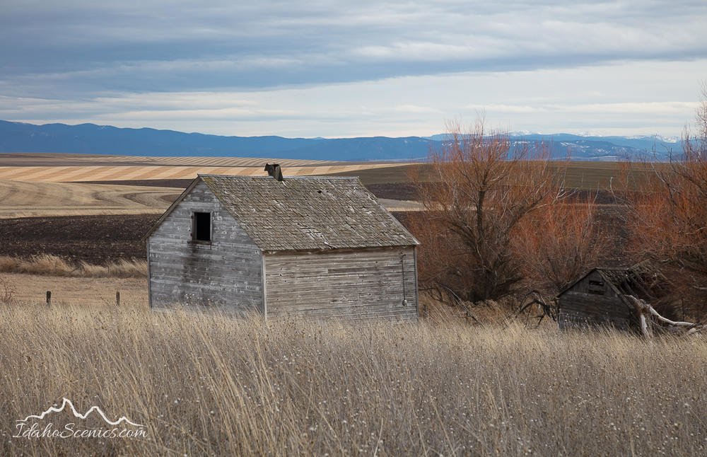
Bygone Era
Big Lost River
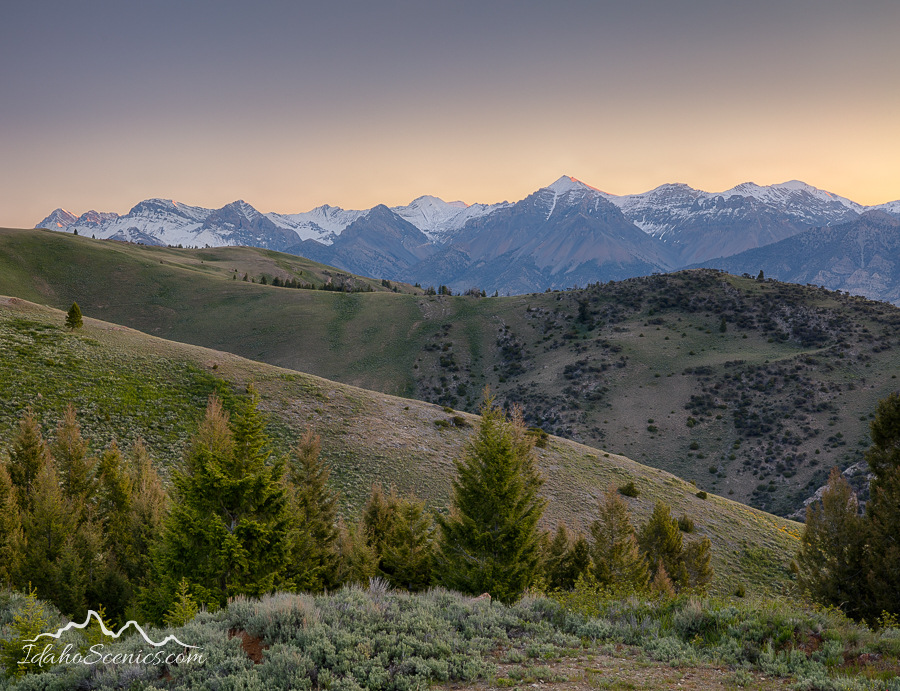
Mountains of Mackay
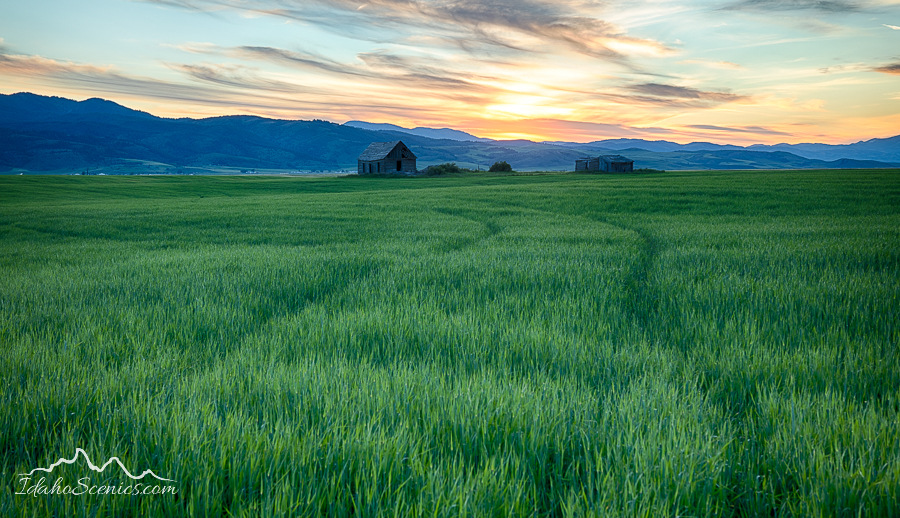
Abandoned in the Wheat
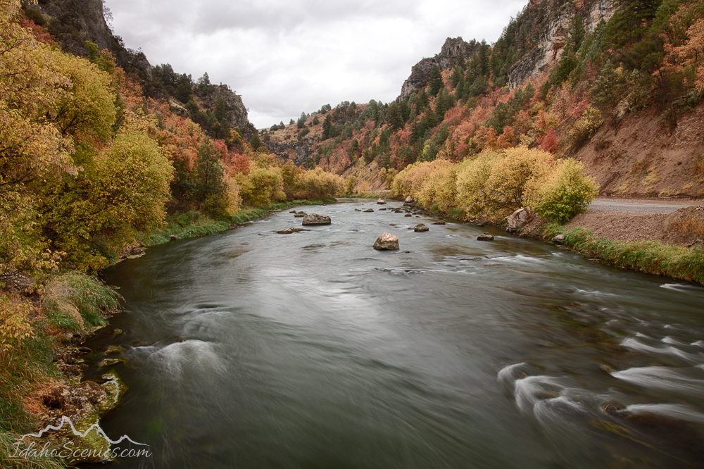
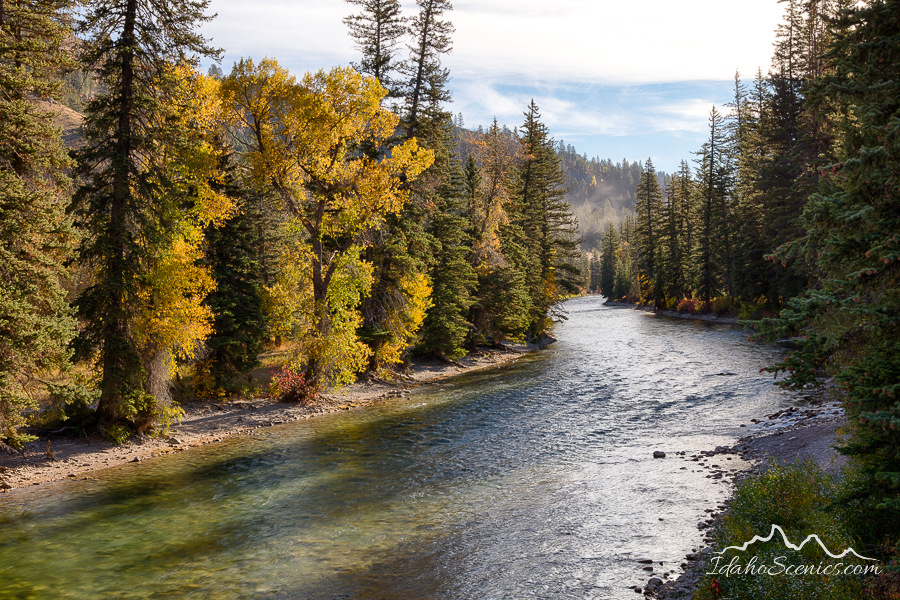
Greys River Autumn
Pomerelle Sunrise
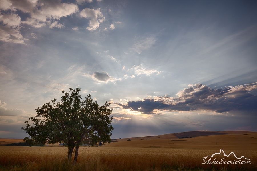
Heart of the Prairie
Chief Joseph Highway
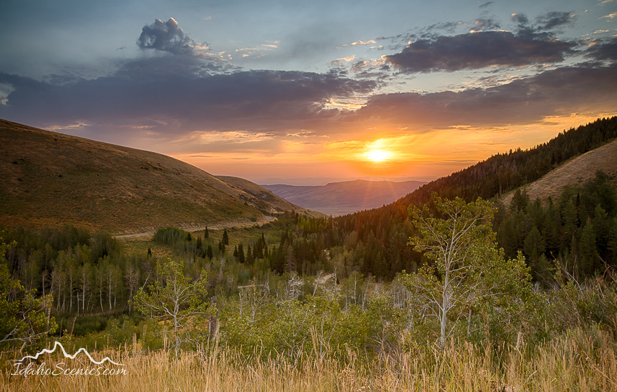
Grand Teton Sunset
Like everyone else, I am happy to be leaving 2020 behind and looking forward to 2021 with hope for brighter days ahead.
With the stay at home order finally lifted and approaching 6 months of no solitary travel, I was eager to hit the road at the first possibility that presented itself. Not being one to ever take a straight route to anywhere, I choose to add a short loop into Montana then took a short cut through the mountains to Lolo Pass which allowed me to make my way down the wild and scenic Lochsa River corridor. I’d never driven the Lochsa route in the spring, and the cottonwoods dispersed along the riverbank were just budding out with light green foliage. I then drove south up the South Fork of the Clearwater River and ended my day on the Camas Prairie at Grangeville.
Idaho, South Central, Custer County, Challis. Sunrise in the Salmon River Mountains in spring.
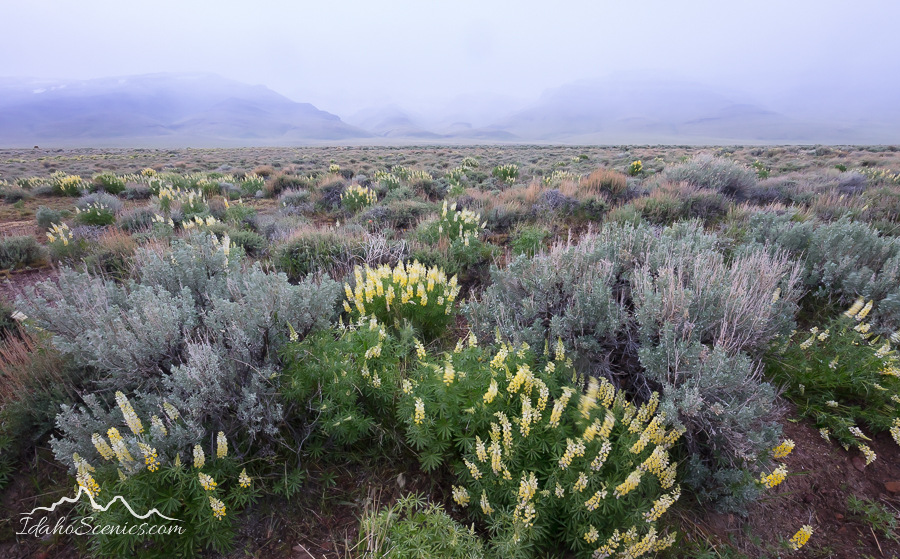
Idaho, Adams County, Council. Spring wildflowers along the Middle Fork Weiser River Road.
Idaho, west, Adams County, Council. The Middle Fork of the Weiser River flowing through the Payette National Forest in spring.
IDaho, Southwestern, Owyhee County, Grand View. Hicks Springs in the Owhee Desert on a spring dawn.
Idaho, North Central, Riggins. Morning sun along the Little Salmon River in spring.
Idaho, East Central, Salmon, North Fork. An old log cabin seen across the Salmon River at Colston access.
Idaho, North Fork, Aspen Trees in spring on Lost Trail Pass.
IDaho, North Central, Riggins. Pre-sunrise over the Main Salmon east of Riggins in spring.
Idaho, North Central, Grangeville. Soft evening light on Canola fields underneath an almost full moon in May.
Idaho, North Central, Grangeville. Soft evening light on a faded red barn underneath an almost full moon in May.
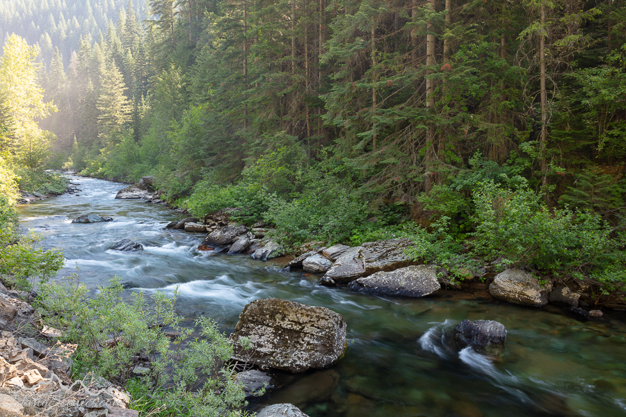
Idaho, Northern, Kootenai County, Kingston, Enaville. Cottonwood trees budding out along the Coeur d’Alene River in spring.
With rain in the forecast for the following morning I headed south on hwy 95 to the dryer climate along the Salmon River. At Riggins I turned east and followed the Big Salmon River Rd. I watched sun rise over an old bridge then continued into the canyon for a visit to Allison Creek, surrounded by an oasis of green. Another venture off the highway on the Middle Fork Weiser River Rd. took me along the scenic creek with patches of wildflowers in bloom along the banks. This shooting experience in the pouring rain was invigorating. I spent the evening shooting assignment work for a client near Boise and retired early to the hotel. Sleep eluded me as it often does when I’m excited and this was the day of my big desert adventure. I left the hotel at 2am and three hours later was deep in the Owyhee Desert doing some map reading under the full moon. About 10 more miles of rough two-track road through the sage and lupine and I could make out the tops of the aspen grove in the predawn light. My oasis destination did not disappoint. Safely back in town I did another quick assignment, then made my way to Challis for the night. I watched sunrise from a ridge top in the Salmon River Mountains, another amazing experience of solitude and grandeur.
Idaho Scenic Images will conduct 2 destination photography workshops this year. The first one is a late spring tour that starts in the town of Fairfield and ends in the town of Bellevue. We’ll shoot on the Centennial Marsh and hope for a sea of blue camas lilies, visit the Little City of Rocks, and photograph a variety of old barns and buildings that dot the prairie. Next we’ll move on to the Wood River Valley for scenic vistas, winding rivers, more wildflowers and mountain views.
It was with the snow rapidly melting here at home and a forecast of rain and temperatures into the 40’s that I left on my annual winter trip in search of fresh snow.
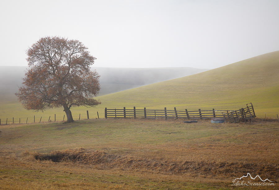
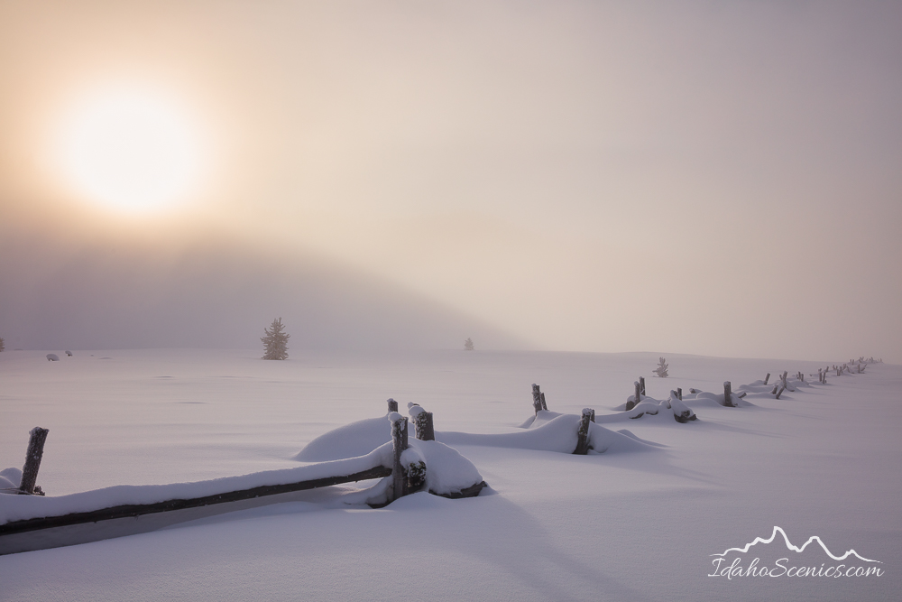
Sunrise Fence
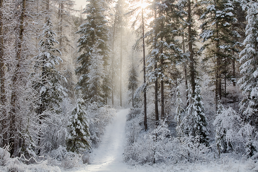
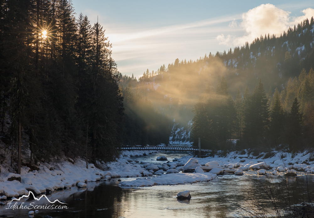
I traveled the snow-less Clearwater River corridor up the Wild and Scenic Lochsa finding snow in the upper reaches of the
Bitterroot Mountains at Lolo Pass.
Lochsa River Mists
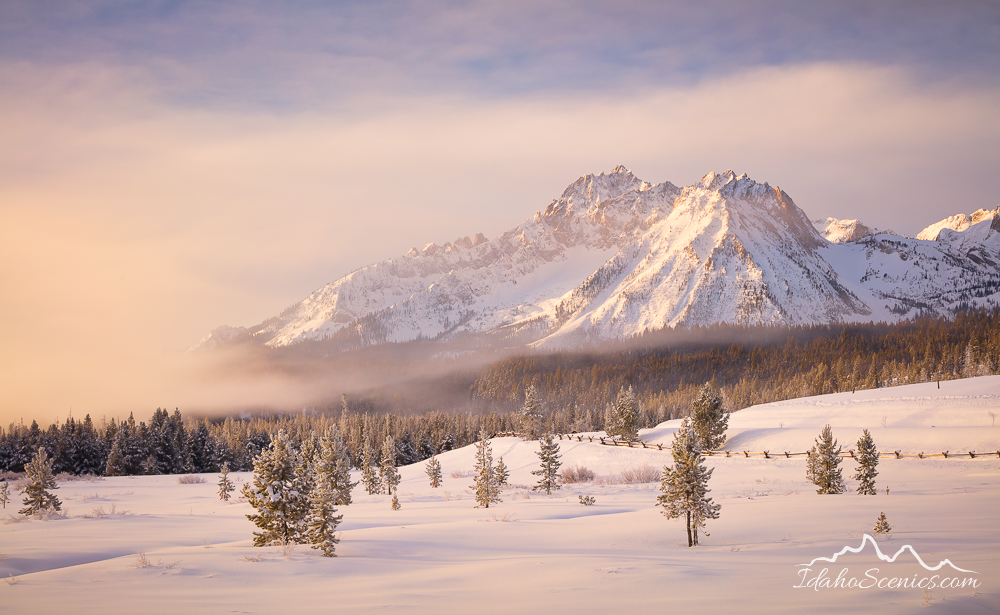
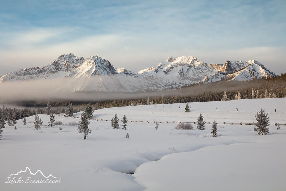
From there I traveled south on Hwy 93 through Challis and followed the Salmon River all the way into Stanley, just in time to catch sunset over the Sawtooth Range.
Sawtooth Winter Morning
Tucked Away
In the morning I witnessed an amazing display of mists dancing around the peaks as the sun came up. Balancing myself and tripod on a 5 foot snowbank surrounded by such beauty, it was easy to ignore the frigid temps for the brief light show.
Magical Moments
Whitewashed
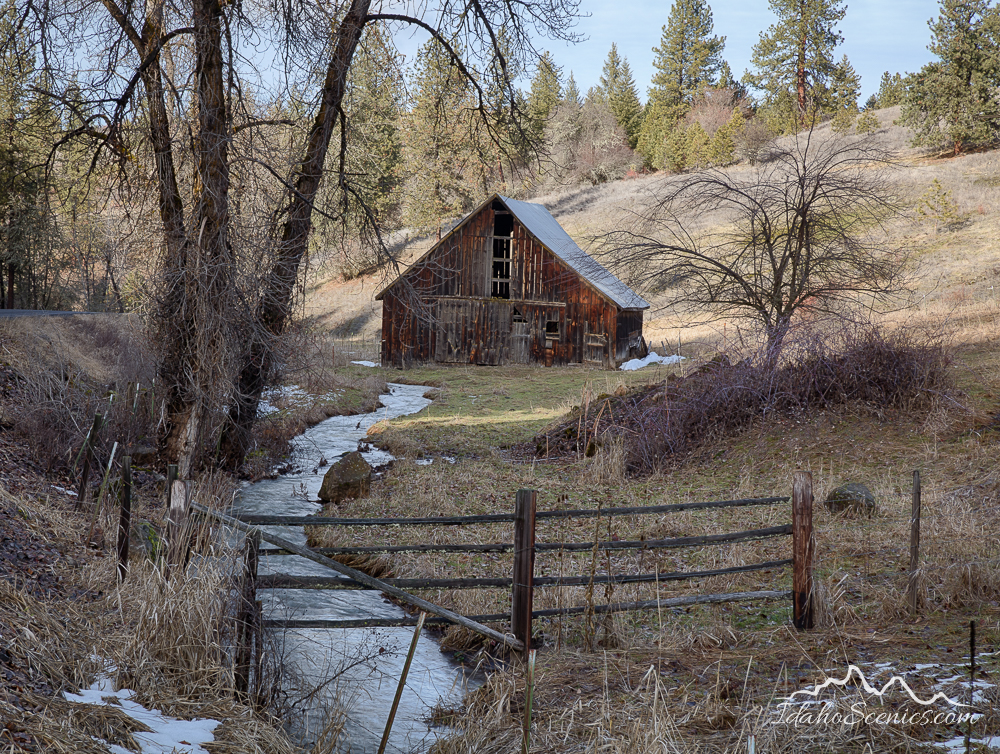
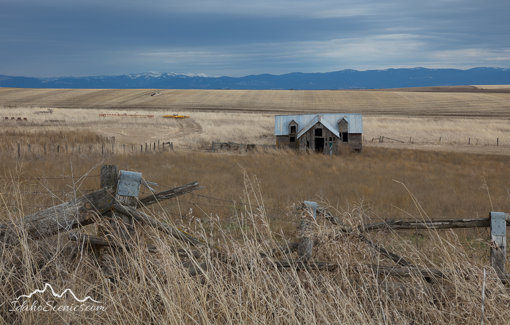
From Stanley I looped through Garden Valley and rejoined Hwy 95 at New Meadows. I found some abandoned barns and buildings on the country roads of the Camas Prairie around Grangeville.
Abandoned on the Camas Prairie
Faded Glory
At Lewiston I completed my circle of Idaho and the rains which I had avoided on my entire loop since leaving home, once again commenced. It was a quick but successful trip!
Landscape photography~ No other activity brings my heart such joy as experiencing sunrise surrounded by the fragrance of mountain wildflowers, watching a lake steam in the first light of an autumn morning, discovering new locations both near and far and listening to the babbling of a mountain stream, or watching the last of the sunset colors fade into night…
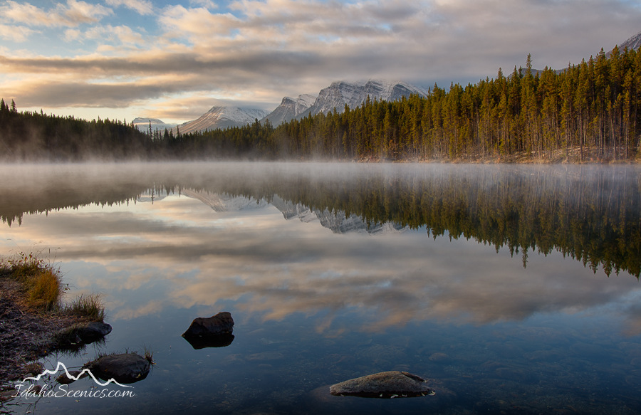
Canada, Alberta, Banff National Park. Herbert Lake at dawn in autumn in the Canadian Rockies.
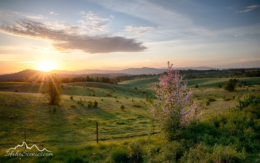
Idaho, North, Kootenai County, Coeur d’Alene. Sunrise over the countryside south of Coeur d’Alene in Spring.
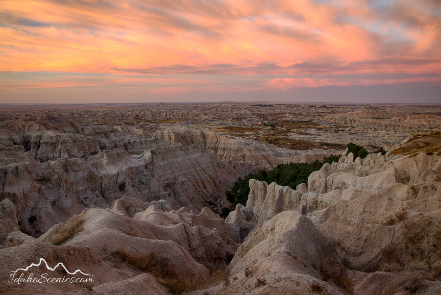
Badlands at dawn, South Dakota
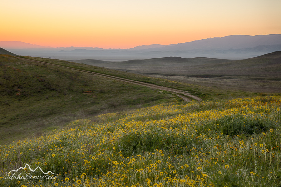
California, west central, Dawn on the Carrizo Plains National Monument in spring.
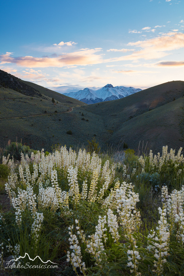
Idaho, south central, Custer County, Mackay. The Lost River Range as viewed at dawn in summer from the White Knob Mountains.
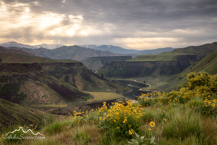
Idaho, Southwestern, Boise, May, Prairie. Sunrise in the the Danskin Mountains in spring with the South Fork of the Boise River and spring sunflowers.
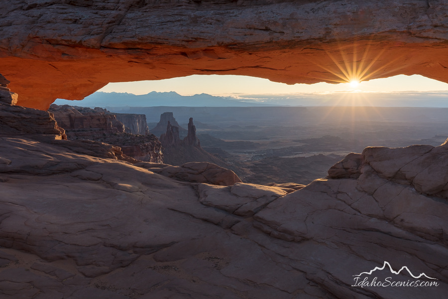
Sunrise through Mesa Arch in Utah
Salmon-Challis National Forest in spring
Idaho, North, Kootenai County, Coeur d’Alene, Fernan. A late summer dawn on Fernan Lake.
California, Central, Santa Cruz, Felton. Henry Cowell Redwoods State Park, Falls Creek Unit.
California, west central, Dawn on the Carrizo Plains National Monument in spring.
Alberta, Canada in autumn
Idaho, central, Custer County, Challis. The Lost River Range bathed in morning light with a setting moon in late spring.
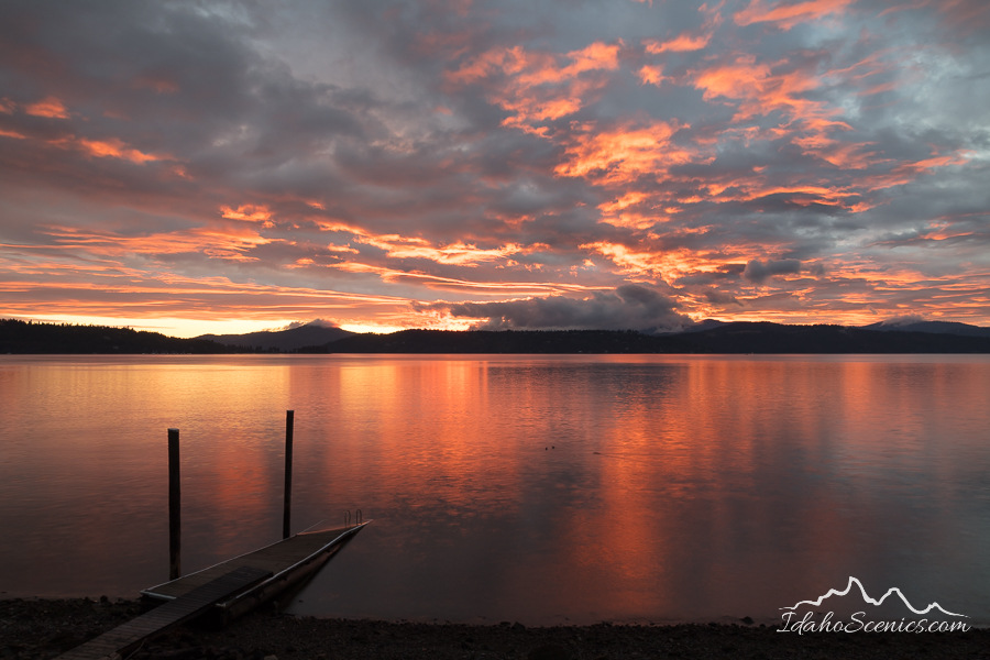
Idaho, North, Kootenai County, Hayden. A late summer sunset over Hayden Lake.
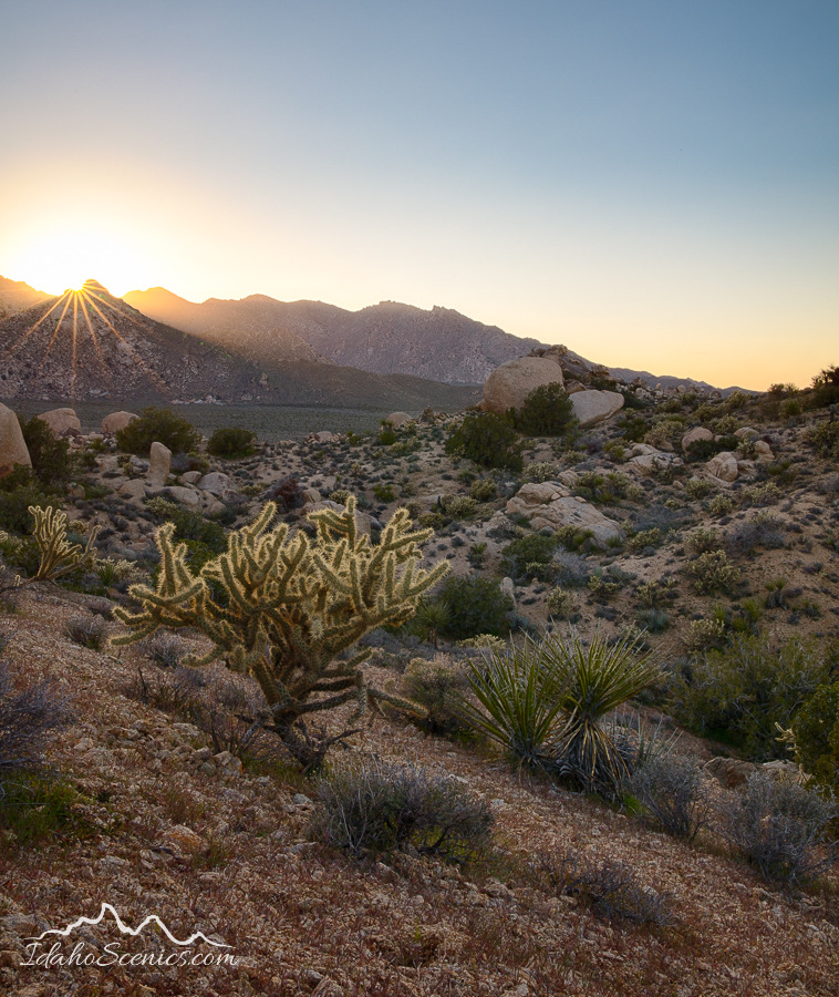
Mojave Desert, California
Idaho, south central, Rogerson. Lupine bloom on the desert in spring in the rain and wind.
Idaho, North, Kootenai County, Coeur d’Alene. A mid autumn clearing storm reveals a colorful sunset over lake Coeur d’Alene.
Idaho, South Central, Mountain Home, Bruneau. Sunrise in winter at Bruneau Dunes State Park.
Idaho, Eastern, Ashton, Tetonia. And old barn below the Teton Range in evening light of autumn.
Idaho, east central, Custer County, Challis, Pahsimeroi Valley. An early autumn dawn over the Lemhi Range and farmlands in the Pahsimeroi Valley.
2019 was a year filled with all of these things and more and for that I am thankful.
It is with a significant sadness in my heart that I will embark upon the medical challenges presented to me going forward into 2020, but also with hope that I may continue pursuing these things that fulfill me.
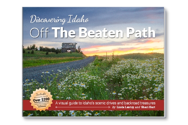
Imagine Idaho…a land of geological wonders…towering peaks, sagebrush deserts, evergreen forests, pristine rivers, lava flows, deep canyons, rolling farmlands, idyllic waterfalls and beautiful lakes….just a few of the iconic images professional photographer Linda Lantzy and award-winning semi-professional Shari Hart have photographed across the Gem State.
Through their thousands of combined hours of exploring and photographing the state of Idaho, Linda and Shari are sharing their knowledge of how to find Idaho’s most photographic scenes in their new guidebook, “Discovering Idaho-Off the Beaten Path.”
If you know where to look, many of these wonderful photographic opportunities can be found just by getting off the interstate. Some locations, however, are far less obvious. As seasoned back-roads artistic photographers, their experiences have led them to hundreds of photographic gems waiting to be discovered.
Among these are old barns, abandoned antique vehicles, and pioneer cabins, along with many other unforgettable locations.
From Route 1 – Bonners Ferry and the Selkirk and Purcell Mountains
“Discovering Idaho-Off the Beaten Path” will provide detailed directions to places you may never have imagined. Complete with maps and visual references, photographic tips and top-notch photography, this outstanding guide is the perfect traveling companion for photographers, sightseers and other like-minded Idaho lovers.
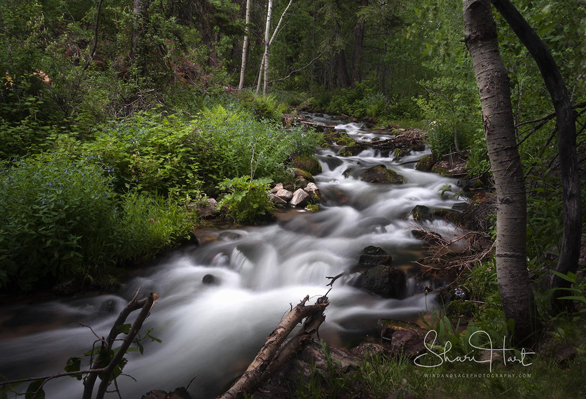
From Route 11 – The Lochsa, Selway and Bitterroot Mountains
To get this beautiful guide going, they are seeking up-front funding to offset a portion of the printing costs. Please visit our GoFundMe campaign and make a donation in exchange for a great reward.